Showing posts with label National Parks. Show all posts

Wednesday, September 23, 2015

Newly built Lodge Inside The Nkasa Lupala National Park Now Open:

The Jackalberry Tented Lodge  


The Jackalberry Tented Lodge, a sister lodge to Nkasa Lupala Tented Lodge. The Lodge is part of an exclusive activity concession from MET and is built inside the Nkasa Lupala National Park formerly known as Mamili National Park.

Jackalberry Tented Lodge welcomes its guest to one of the most unique areas in Zambezi region, the wet land paradise for ultimate adventure.


The main building is build around a huge Jackalberry tree and has first and second floors that houses the reception area, dinning area, lounge and bar area. The second floor has spacious and comfortable lounge providing guests with an exceptional view of the surrounding while the ground floor hosts communal fire place for evening catch up.


3 Twin Room and 1 Honeymoon Double Room; with side lamps, camping fridge, in room bathroom, coffee/tea station, hot water generated by a solar power, offering a superb eco-friendly personalized safari experience. All rooms are made of customized large tents and has a raised deck offering breathtaking views across the lagoons. Maximum of 2 pax allowed. 

The lodge enjoys its prime location which make a perfect base for Park experience and exploration. The lodge is located on the Linyanti river lagoons where a large population of the park’s wildlife roams freely and could be spotted from the lodge decks through the floodplains of Namibia and woodlands of Botswana just across the river.

For more information and for your booking request please contact us via email:

Monday, September 7, 2015

Namibian National Parks and Game Reserves

Mahango Game Park 
 The Mahango Game Park is a protected area in Namibia within Bwabwata National Park. It is situated at the country's eastern border with Botswana in the flood plains of the Okavango River basin, close to the Popa Falls on the river. 


Erindi Private Game Reserve
Erindi Private Game Reserve is situated 40 km east of Omaruru. Far away in Africa, a country exists where it is still possible to wander in a landscape that contains many more creatures than people. On a vast mountainous plain lies Erindi, translated as "The Place of Water" in local Herero, with more than 12 000 head of game teeming over an unbelievably large game reserve, where even rare and endangered species are being conserved and managed in a manner that allows man to experience what it was once like to live in undisturbed Africa. 

http://www.namibiareservations.com/erindi.html

NamibRand Nature Reserve  
The NamibRand Nature Reserve, located in southern Namibia, is a private nature reserve established to help protect and conserve the unique ecology and wildlife of the south-west Namib Desert.  Conserving the pro-Namib, the area along the eastern edge of the Namib Desert, is critically important in order to facilitate seasonal migratory wildlife routes and to protect biodiversity. 

http://www.namibiareservations.com/namibrand_family_hideout.html

Waterberg National Park
 Waterberg National Park is a national park in central Namibia on the Waterberg plateau, 68 kilometres (42 mi) south-east of Otjiwarongo. The plateau and the national park are named after the prominent table mountain that rises from the plateau, the Waterberg (Afrikaans: Water Mountain). The Waterberg Plateau is a particularly prominent location, elevating high above the plains of the Kalahari of Eastern Namibia. Waterberg Park and some 405 square kilometres (156 sq mi) of surrounding land were declared a Nature Reserve in 1972. As the plateau is largely inaccessible from beneath several of Namibia's endangered species were relocated in the early 1970s to protect them from predators and poaching to extinction.

http://www.namibiareservations.com/waterberge.html

Etosha National Park
In the vast arid space of Northern Namibia lies one of Southern Africa’s best loved wildlife sanctuaries. Etosha National Park offers excellent game viewing in one of Africa’s most accessible venues. Zebra and springbok are scattered across the endless horizon, while the many waterholes attract endangered black rhinoceros, lion, elephant and large numbers of antelope.

http://www.namibiareservations.com/etosha.html

For more information please contact us at 

Friday, June 26, 2015

Western Caprivi in Namibia

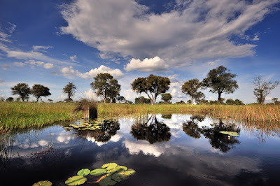
Namibia's wild and seldom visited Nkasa Rupara (formerly Mamili) National Park is a watery wonderland of wildlife rich islands, river channels and wetlands. In many ways the park mirrors Botswana's Okavango Delta.Wild is the best word to describe this park, there's nothing fancy about, no luxurious campsites or guided tours, you're on your own, driving on a series of unmarked 4x4 trails. Nkasa Rupara holds the distinction of being the largest wetland area with conservation status in Namibia.

http://www.namibiareservations.com/eastcaprivie.html

The focal points of the 320km² national park are Nkasa and Lupala, two large islands in the Kwando / Linyati river. During the dry season the islands can be reached by road but after the rains 80% of the area becomes flooded, cutting them off from the mainland. The good news is that it remains a sanctuary for birds, with more species of birds recorded here than anywhere else in Namibia.


In addition to large herds of elephants and buffalo, lion, leopard, spotted hyena, giraffe, impala, red lechwe, reedbuck and the elusive sitatunga can be seen.


The splendid Nkasa Lupala Lodge borders the park to the north - and as the are is unfenced much of the wildlife from the park wanders through the property. Nakasa Lupala lodge also has exclusive rights to offer game drives in the park as well as game viewing from a boat on the Linyanti (a very exclusive experience) - so those wanting a little more than a self drive experience in the park should consider spending time at the lodge.

http://www.namibiareservations.com/nkasa_lupala_lodge.html


For more information please contact us at 

Friday, May 2, 2014

Namibia - A land of wonders

With well graded roads leading to uncrowded, magical landscapes from spectacular vast desert and the world’s highest sand dunes to national parks teeming with wildlife – Namibia is an adventure waiting to be explored.

 Although the entire coastline of Namibia was formerly called The Skeleton Coast, more commonly today it refers only to the Skeleton Coast National Park. The park stretches from the Kunene River in the north for approximately 500km to the Ugab River in the south, and protects about one-third of Namibia's coastline


 The Fish River Canyon in Namibia is (allegedly) the 2nd largest canyon in the world after the Grand Canyon. The immensity of this magnificent landscape is truly breathtaking. The towering rock faces and deep ravines were formed by water erosion and the collapse of the valley due to movements in the earth's crust over 500 million years ago. Today the canyon measures 160km long up to 27km wide and almost 550m at its deepest. It is fair to say that when you arrive at the canyon though, its exact location is a bit of a mystery as the 500m vertical drop from the flat dry plateau is completely out of view.

 Etosha, meaning "Great White Place", is dominated by a massive mineral pan. The pan is part of the Kalahari Basin, the floor of which was formed around 1000 million years ago. The Etosha Pan covers around 25% of the National Park. The pan was originally a lake fed by the Kunene River. However the course of the river changed thousands of years ago and the lake dried up. The pan now is a large dusty depression of salt and dusty clay which fills only if the rains are heavy and even then only holds water for a short time. This temporary water in the Etosha Pan attracts thousands of wading birds including impressive flocks of flamingos. The perennial springs along the edges of the Etosha Pan draw large concentrations of wildlife and birds.

 The sand dunes of Sossusvlei in the Namib Desert are often referred to as the highest dunes in the world. Various arguments are laid out to support this claim, but all miss the point, which is that Sossusvlei is surely one of the most spectacular sights in Namibia. Located in the Namib Naukluft park, the largest conservation area in Africa, and fourth largest in the world - the sand dunes at Sossusvlei are just one excellent reason to visit Namibia. The best time to view Sossusvlei is close to sunrise and sunset; the colours are strong and constantly changing, allowing for wonderful photographic opportunities.

The Spitzkoppe (from German for "pointed dome"; also referred to as Spitzkop, Groot Spitzkop, or the "Matterhorn of Namibia"), is a group of bald granite peaks or bornhardts located between Usakos and Swakopmund in the Namib desert of Namibia. The granite is more than 700 million years old and the highest outcrop rises about 1,784 metres (5,853 ft) above sea level. The peaks stand out dramatically from the flat surrounding plains. The highest peak is about 700 m (2,300 ft) above the floor of the desert below.

The Namib-Naukluft National Park is a national park of Namibia encompassing part of the Namib Desert (considered the world's oldest desert) and the Naukluft mountain range. With an overall area of 49,768 km2 (19,216 sq mi), the Namib-Naukluft is the largest game park in Africa and the fourth largest in the world. The most well-known area of the park is Sossusvlei, which is the main visitor attraction in Namibia. A surprising collection of creatures survives in the hyper-arid region, including snakes, geckos, unusual insects, hyenas, gemsboks and jackals. More moisture comes in as a fog off the Atlantic Ocean than falls as rain, with the average 106 millimeters of rainfall per year concentrated in the months of February and April.

Twyfelfontein (Afrikaans: uncertain spring), officially known as ǀUi-ǁAis (Damara/Nama: jumping waterhole), is a site of ancient rock engravings in the Kunene Region of north-western Namibia. It consists of a spring in a valley flanked by the slopes of a sandstone table mountain that receives very little rainfall and has a wide range of diurnal temperatures.The site has been inhabited for 6,000 years, first by hunter-gatherers and later by Khoikhoi herders. Both ethnic groups used it as a place of worship and a site to conduct shamanist rituals. In the process of these rituals at least 2,500 items of rock carvings have been created, as well as a few rock paintings.

Friday, November 29, 2013

The Skeleton Coast of Namibia

The Skeleton Coast is the northern part of the Atlantic Ocean coast of Namibia and south of Angola from the Kunene River south to the Swakop River, although the name is sometimes used to describe the entire Namib Desert coast.


The area's name derives from the whale and seal bones that once littered the shore from the whaling industry, although in modern times the coast harbours the skeletal remains of the shipwrecks caught by offshore rocks and fog.

 On the coast the upwelling of the cold Benguela current gives rise to dense ocean fogs (called "cassimbo" by the Angolans) for much of the year. The winds blow from land to sea, rainfall rarely exceeds 10 millimetres (0.39 in) annually and the climate is highly inhospitable. There is a constant, heavy surf on the beaches. In the days of human-powered boats it was possible to get ashore through the surf but impossible to launch from the shore. The only way out was by going through a marsh hundreds of miles long and only accessible via a hot and arid desert.


Tuesday, January 18, 2011

Ai-Ais/Richterfeld high flood levels

SANParks has announced the closure of all campsites in the Richtersveld section of the /Ai-/Ais-Richtersveld Transfrontier Park until further notice.
The closure of the campsites has been necessitated by the high level of the Orange River which is expected to rise above its 1988 level of 11 m at Noordoewer when the flood peaks in the Lower Orange River.
SANParks says in a news release the campsites at De Hoop, De Koei, Tatasberg, Richtersberg, Kokerboomkloof, Hakkiesdoring, Potjiespram, as well as at Sendelingsdrift Campsite have been closed. Accommodation in the chalets at Sendelingsdrift will, however, still be available.
The flood has also affected the operations of private accommodation establishments downstream of Noordoewer.
The Namibian Roads Authority has, meanwhile, announced the closure of the DR212 gravel road along the northern bank of the Orange River between Aussenkehr and Sendelingsdrift.
Operations of the pontoon at Sendelingsdrift, which facilitates the flow of traffic between the Richtersveld section of the park and Namibia, have been suspended for more than a week because of the high level of the river and the pontoon is expected to remain close for some time to come.
The Orange River reached a record high of 11.39 m at Noordoewer in 1974 and stood at 7 m in February last year when it reached its highest level in 23 years.
Derived from TourNamibia

Thursday, December 30, 2010

Dorob National Park regulations expected to be announced in January 2011

The regulations for the newly proclaimed Dorob National Park are expected to be announced in the first week of January 2011.

Following the park’s proclamation on 1 December 2010, holidaymakers in the former National West Coast Recreation Area (which forms the core of the park) complained bitterly about the enforcement of the regulations – which were never publicized.
The coastal office of the Afrikaans daily, Republikein, reports that the park regulations will differ from those in other conservation areas in the interior. Provision will be made for recreation activities such as walking along the beach and in the Swakop River, as well as the walking of pets in certain areas such as the Swakop River Valley.
According to Republikein most of the problems were reported from Mile 72 where spot fines were issued to visitors who did not pass through the gate of the popular campsite on their way to fishing spots along this stretch of coast. Reports were also received of horse-riders and people walking their dogs in the Swakop River being ordered to leave the area by over-zealous Ministry of Environment and Tourism officials.
The proclamation of the Dorob National Park has also raised questions about the status of the Messum Crater – a popular destination with 4x4 enthusiasts. Republikein’s office at the coast has since established that the inland boundary of the Dorob National Park follows the original boundary of the National West Coast Recreation Area. The boundary cuts through the centre of the crater and the western half of the crater, therefore, now falls in the Dorob National Park.
Off-road enthusiasts are advised to familiarise themselves with the new regulations (when they are made public) – especially with regard to off-road travel.
Derived from TourNamibia

Wednesday, December 22, 2010

Dorob National Park - Namibia's 8th National Park

The creation of the first mega-park in Namibia is now one step closer, following the proclamation of the Dorob National Park.
The newly proclaimed park incorporates the former National West Coast Recreation Area, which stretches from the Ugab River southwards to just north of Swakopmund, as well as a large swathe of the Namib section of the Namib-Naukluft Park.
The 780 000 ha National West Coast Recreation Area was proclaimed in 1973, but as it did not enjoy the same status as game and national parks little could be done to prevent indiscriminate off-road driving and the control of quad bikes, as well as other conservation regulations.
This area, which is renowned for its excellent fishing, is also an important breeding ground of the Damara tern. It also has several extensive lichen fields such as those at Wlotzkasbaken and northeast of Cape Cross.
Among the areas excluded from the park are the following: the railway line between Arandis, Swakopmund and Walvis Bay, the municipal areas of Swakopmund, Walvis Bay and Hentiesbaai, the peri-urban area of Wlotzkasbaken, Cape Cross Lodge, the Cape Cross Seal Reserve, proclaimed roads and several farms in the Swakop River.
The Dorob National Park borders in the south on the Namib-Naukluft Park which in turn is bounded by the Sperrgebiet National Park. North of the Ugab River, the Dorob National Park borders on the Skeleton Coast Park which is to become a transfrontier park with the Ioana National Park in Angola in terms of a memorandum of understanding signed between the governments of Namibia and Angola in 2003.
The establishment of the Dorob National Park on 1 December 2010 is the final piece of the puzzle which will enable Namibia’s conservation authorities to proclaim a mega-park, provisionally named the Namib Skeleton Coast National Park (NSCNP). It will stretch between the Orange River and the Kunene River and will also adjoin the IAi-IAis/Richtersveld Transfrontier Park (between Namibia and South Africa) in the south.
The 10.754 million hectare mega-park will be the 6th largest terrestrial park in the world and the largest in Africa.

Derived from TourNamibia
Information can also be viewed on the Republikein News paper as Afrikaans version: http://www.republikein.com.na/politiek-en-nasionale/toerisme-en-omgewingsake/dorob-kry-status.118451.php
We will keep you updated with more information coming soon!